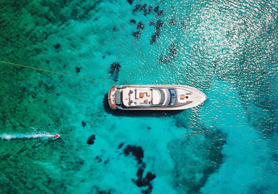
Whether you are an experienced skipper chartering a superyacht or a beginner embarking on your first voyage on a chartered yacht, understanding navigation is crucial for successful sailing. Navigation, the process of accurately determining one’s position and planning and following a route, has fascinated mankind for centuries. This article delves into the concept of navigation, its purpose, and its historical evolution, highlighting key milestones and technological advancements. For those involved in yacht rental, mastering navigation is particularly essential to ensure a safe and enjoyable journey on the open waters.
What is Navigation and Why is it Used?
Navigation is the science and skill of determining a vessel’s position, plotting a course, and steering to a desired destination. It is used to ensure safe and efficient travel across the seas, avoiding hazards and optimizing routes. Navigation has been essential for exploration, trade, and communication throughout history, allowing civilizations to expand their horizons and connect with distant lands.
The Evolution of Navigation Techniques
Star Navigation
In ancient times, sailors relied on celestial navigation, using the stars, the sun, and the moon to determine their position at sea. By observing the positions of celestial bodies, mariners could estimate their latitude. The North Star (Polaris) was particularly important for northern hemisphere sailors, as its position in the sky is almost directly above the North Pole, providing a reliable reference point for navigation. Ancient sailors also used star charts and knowledge of constellations to guide their journeys.
To navigate by stars, sailors employed an instrument called an astrolabe, which measured the altitude of a star above the horizon. By knowing the star’s position and the time of year, they could determine their latitude. This method, while not foolproof, allowed for relatively accurate navigation and enabled mariners to venture further from sight of land.
Compass and Maps
The invention of the compass marked a significant milestone in the history of maritime navigation. Originating in China in the 11th century, the magnetic compass made its way to Europe by the 12th century. The compass allowed sailors to determine their direction even in the absence of visible celestial landmarks, enhancing their ability to maintain a consistent course.
Early compasses consisted of a magnetized needle floating in a bowl of water, free to align itself with the Earth’s magnetic field. This simple yet effective tool enabled sailors to determine the cardinal directions (north, south, east, and west), revolutionizing sea travel. Coupled with increasingly accurate maps and charts, the compass allowed mariners to navigate more confidently and venture into previously uncharted waters.
Chronometer
In the 18th century, English watchmaker John Harrison developed the first accurate marine chronometer, which became a crucial tool for determining longitude at sea. Before the chronometer, sailors had no reliable method to measure longitude, leading to significant navigational errors. Harrison’s chronometer allowed for precise timekeeping, enabling mariners to compare the local time at sea with a known reference time (usually Greenwich Mean Time).
By calculating the time difference, sailors could determine their longitude, greatly improving navigation accuracy and safety. The marine chronometer was a key innovation that transformed long-distance sea travel, making it possible to navigate across vast oceans with a new level of precision.
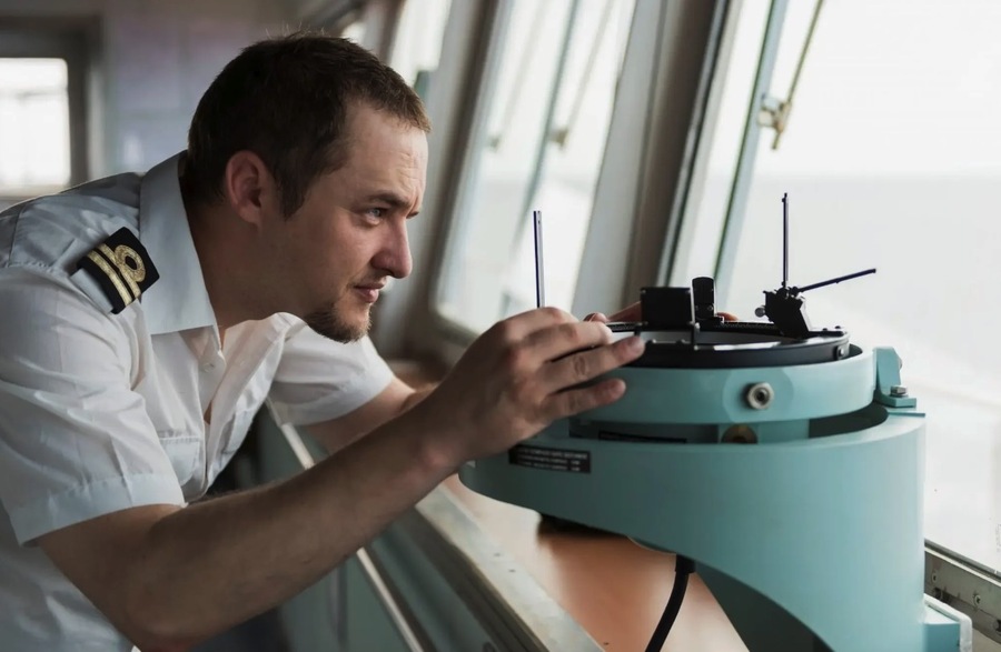
Radar
The advent of radar in the 20th century marked another significant leap in maritime navigation. Radar, which stands for Radio Detection and Ranging, uses the transmission and reception of radio waves to detect objects such as buoys, other vessels, and potential hazards.
Radar technology allows for safe navigation in low visibility conditions, such as fog, rain, or nighttime, by providing real-time information about the surrounding environment. This advancement significantly reduced the risk of collisions and groundings, enhancing the safety of maritime operations. Modern radar systems are capable of detecting objects at considerable distances, giving sailors ample time to react to potential dangers.
GPS Navigation
In the 21st century, the Global Positioning System (GPS) revolutionized navigation. GPS, a satellite-based system, provides accurate and continuous position data to users anywhere on Earth. By receiving signals from a network of satellites, a GPS receiver can determine its precise location, speed, and time.
This technology has become indispensable for modern navigation, offering unparalleled accuracy and convenience. GPS has transformed not only maritime navigation but also aviation, land transportation, and personal navigation, making it one of the most significant technological advancements in history. The system’s ability to provide real-time location data has enhanced the safety and efficiency of maritime travel.
AIS (Automatic Identification System)
The Automatic Identification System (AIS) is another modern innovation that enhances maritime safety. AIS transmits and receives information about the position, course, speed, and identity of AIS-equipped vessels. This data is shared among nearby ships and coastal authorities, increasing situational awareness and reducing the risk of collisions.
AIS is particularly valuable in busy shipping lanes and congested ports, where accurate information about vessel movements is critical for safe navigation. The system operates continuously, providing a real-time view of maritime traffic and helping to prevent accidents.
EPIRB (Emergency Position Indicating Radio Beacon)
The Emergency Position Indicating Radio Beacon (EPIRB) is an emergency device used to transmit a distress signal in case of an emergency or danger. When activated, an EPIRB sends a signal to satellites, which relay the distress message to search and rescue authorities.
This technology is crucial for maritime safety, providing a reliable means of calling for help and facilitating rapid response in life-threatening situations. EPIRBs are designed to be durable and capable of operating in harsh conditions, ensuring that distress signals can be sent even in the most challenging environments.
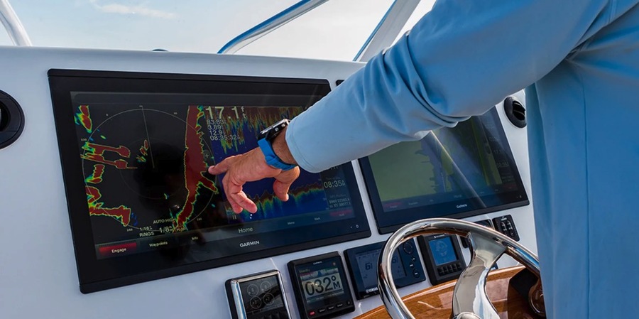
Electronic Nautical Charts
Paper nautical charts are gradually being replaced by electronic nautical charts (ENCs), which offer numerous advantages. Modern navigation systems can download and display detailed electronic marine charts, providing real-time updates and interactive features.
ENCs enhance navigation by offering precise information, route planning tools, and integration with other navigational aids. This shift towards digital navigation tools reflects the broader trend of technological advancement in maritime operations. Electronic charts are more easily updated and can provide additional layers of information, such as weather data and marine traffic.
Mobile Navigation Apps
The proliferation of marine applications for smartphones and tablets has further transformed yacht navigation. Mobile navigation apps provide access to charts, weather updates, route planning, and real-time tracking, making navigation more accessible and convenient.
While these apps are valuable tools, they complement rather than replace the experience, skill, and judgment of the skipper and crew. Familiarity with these navigational aids and continuous improvement of sailing skills are essential for safe and smooth sailing. Mobile apps also offer features such as social sharing and community-sourced information, enhancing the overall navigation experience.
Conclusion
Navigation has evolved tremendously over the centuries, from ancient star navigation to modern GPS and digital tools. Each advancement has brought greater accuracy, safety, and convenience to maritime travel. However, the experience and skill of the skipper and crew remain paramount. Familiarity with navigational aids and continuous learning are key to successful sailing. Remember, safety always comes first, and a well-trained sailor is always prepared to tackle the challenges of the sea.

Surfer, foodie, record lover, Swiss design-head and ADC member. Performing at the sweet spot between simplicity and elegance to create not just a logo, but a feeling. Let’s chat.